Geophysical Surveys
Geophysical Surveys
Essar Infratech offers comprehensive geophysical survey services for Civil engineering projects in compliance with Indian Standards. These surveys play a crucial role in understanding subsurface conditions, identifying potential hazards, and optimizing foundation designs. Essar Infratech uses state-of-the-art equipment and skilled professionals to conduct accurate and reliable geophysical investigations.
- Some of the key geophysical survey methods employed by Essar Infratech include:
- Seismic Refraction (IS 1892:1979): Seismic refraction is a geophysical technique used to determine the subsurface layer's velocity structure and estimate the depth and thickness of various layers. This method helps identify bedrock depth, groundwater table, and other subsurface features essential for geotechnical engineering projects. Essar Infratech uses advanced seismographs and geophones for high-resolution data acquisition.
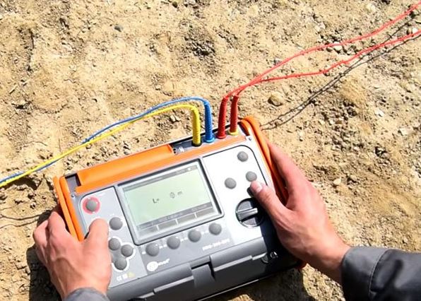
- Electrical Resistivity (IS 3027:1965, IS 11592:1985): Electrical resistivity surveys measure the subsurface's electrical resistance, which is influenced by soil composition, moisture content, and compaction. This technique is useful for identifying subsurface geological features, groundwater resources, and detecting contamination. Essar Infratech employs cutting-edge resistivity meters and electrode arrays for accurate measurements.
- Ground Penetrating Radar (GPR): Although not explicitly mentioned in Indian Standards, GPR is a non-invasive technique used to create high-resolution images of subsurface structures. This method helps detect buried utilities, reinforcement bars, and other embedded features in civil engineering projects. Essar Infratech utilizes state-of-the-art GPR equipment for high-resolution subsurface imaging.
- Gravity and Magnetic Surveys: Gravity and magnetic surveys are used to map subsurface density and magnetic anomalies, which provide valuable information about geological structures, depth to bedrock, and subsurface voids. Essar Infratech employs advanced gravimeters and magnetometers to perform these surveys with high precision.
- Borehole Logging (IS 6939:1973): Borehole logging provides continuous measurements of physical properties along a borehole's depth. It helps characterize subsurface conditions, identify fractures and faults, and determine groundwater levels. Essar Infratech uses sophisticated logging tools such as gamma-ray, resistivity, and sonic probes for detailed subsurface profiling.
Essar Infratech’s commitment to using top-of-the-line equipment and adhering to Indian Standards ensures that our geophysical surveys provide accurate, reliable, and actionable information for geotechnical engineering projects. By leveraging these advanced survey techniques, Essar Infratech helps clients make informed decisions, reduce project risks, and optimize design solutions for a wide range of projects.